Location & Maps
BY: BG EDITOR
Greenwood, British Columbia, Canada
Longitude: 118º 40' 37"W | Latitude: 49º 05' 18"N
July, 2016 — GREENWOOD, BC (BG)
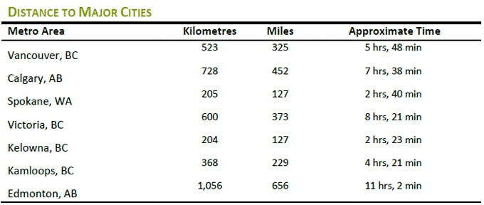
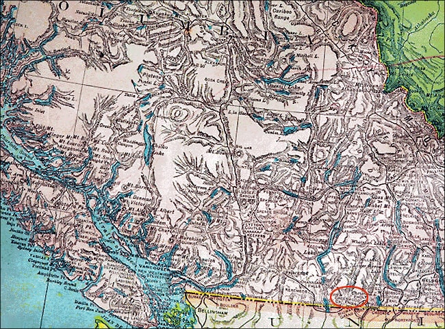
Greenwood is located in south central British Columbia, just 13 kilometers (8 miles) north of the Canada/United States border. We are 80 km (50 mi) east of Osoyoos and 36 km (22 mi) west of Grand Forks.
Situated in the southern Monashee Mountains at an elevation of 748 meters (2,454 feet), Greenwood lies in the transition zone between the semi-arid Okanagan Valley and the interior rainforest of the Kootenay Rockies region. Greenwood was built on the banks of Boundary Creek, which flows through a narrow valley, with Jubilee Mountain rising to the west and an unnamed ridge behind town, to the east that gradually rises to meet Phoenix Mountain.
Heading east from Vancouver and the Lower Mainland, the most direct line of travel to Greenwood is on the Crowsnest Highway. This Interprovincial highway (Highway 3) crosses several mountain passes and valleys en route to Greenwood. Leaving Hope, the Crowsnest traverses Allison Pass, the Similkameen, and the Okanagan Valley. Heading south through Osoyoos, it then travels east, hugging the Canada/U.S. border (the 'boundary'), crosses over Anarchist Mountain and into the Kootenay-Boundary district.
Heading east from Greenwood, the Crowsnest Highway continues to be the most direct route along B.C.'s southern boundary, crossing into Alberta, over the Crowsnest Pass and intersecting Hwy 2 which goes north into Calgary. This 1,161 km (721 mi) highway is designated a core route in Canada's National Highway System.
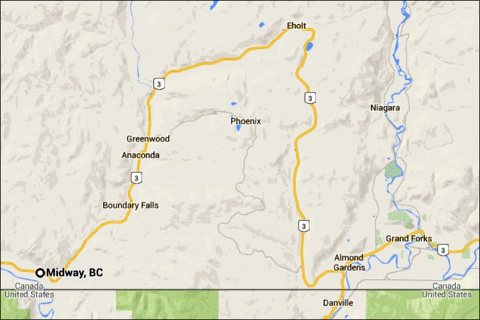
Greenwood is situated at the mid-point of the West Kootenay-Boundary region. 'The Boundary' is comprised of the communities of Midway, Rock Creek, Westbridge, Beaverdell and Bridesville to the west of Greenwood. To its east are Phoenix, Eholt, Grand Forks and Christina Lake.
Extending beyond the central Boundary is the broader Regional District of Kootenay Boundary (RDKB), which includes the cities of Rossland and Trail.